When atmospheric conditions are right, wildfires can create their own weather—monstrous fire-induced thunderstorms called pyrocumulonimbus clouds (“pyro” from the Ancient Greek word pyr meaning fire and “cumulonimbus” indicating cloud type), or pyroCb for short. “PyroCbs act as giant chimneys,” says Dr. David Peterson, a meteorologist at the U.S. Naval Research Laboratory (NRL) Marine Meteorology Division in Monterey, California, and subject matter expert on pyroCbs. They pull smoke released by the fire upward through the fire-induced thunderstorm core, “releasing the resultant smoke plume at the altitude that thunderstorm tops reach, often at the cruising altitudes of jet aircraft or higher.”
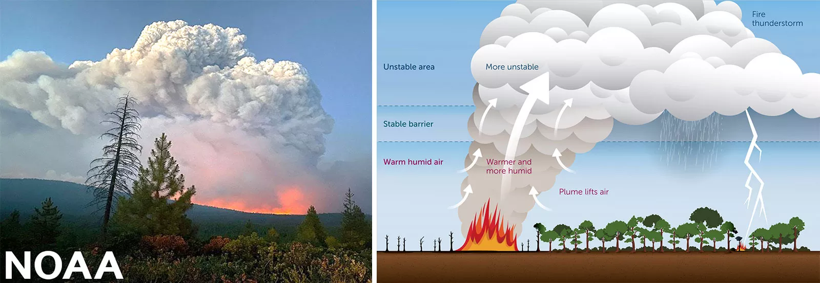
PyroCbs are capable of producing lightning, hail, strong downdraft winds, and even tornadoes, any of which can severely impact aviation, firefighting, public safety, ecosystems, and climate. What’s more, the magnitude of a pyroCb smoke plume can rival that of a volcanic eruption, rising into the stratosphere and having far-reaching impacts on regional and global climates, such as changes in stratospheric wind behavior and long-distance smoke transport.
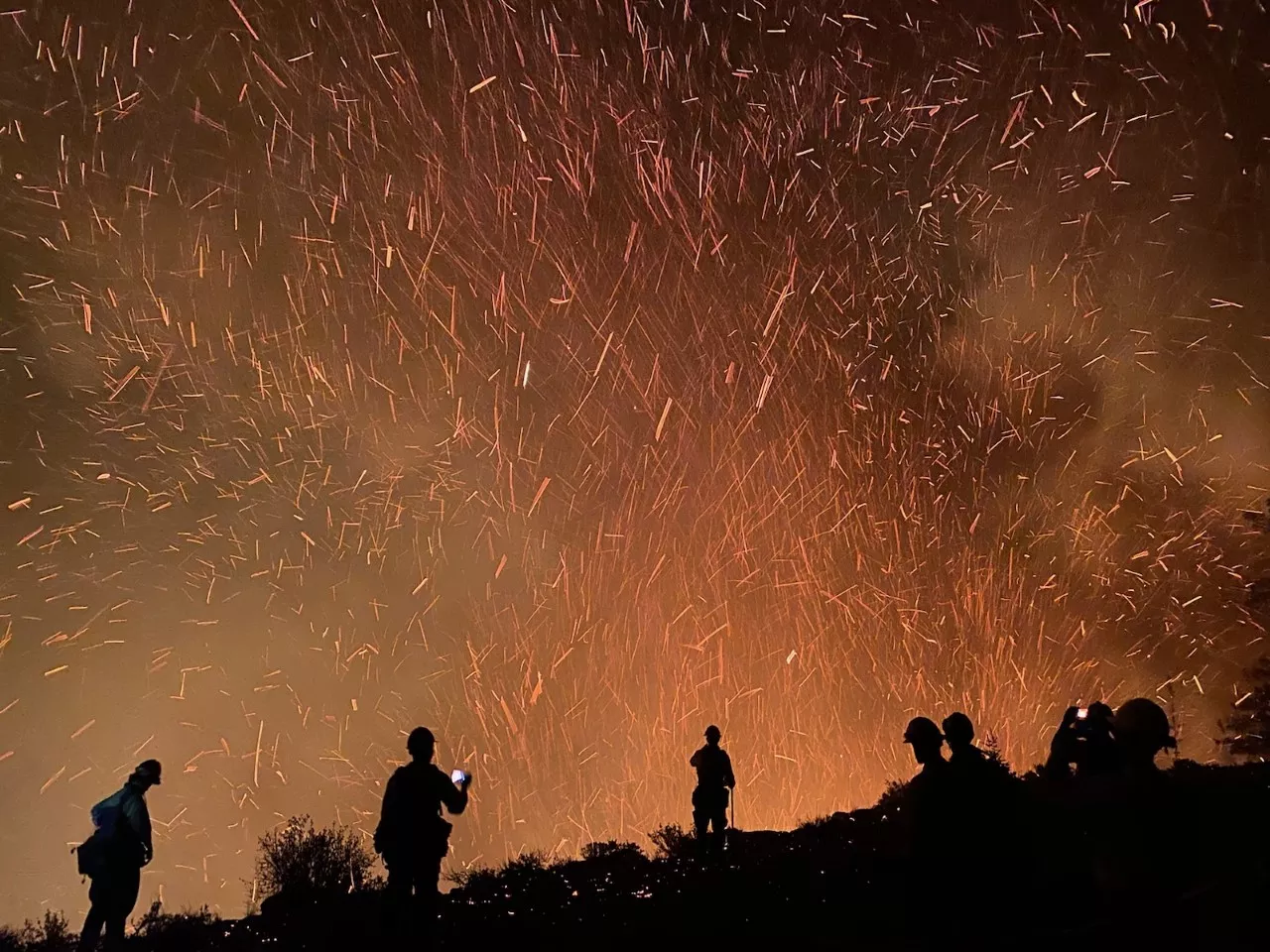
At ground-level, the billowing height and opaqueness of a pyroCb will blanket out the sun, turning daylight into darkness. Hot and chaotic winds from pyroCbs are erratic and can produce fire whirls and ember showers that can ignite new fires downwind. “All this is to say that pyroCbs can be both complicated and life-threatening to ground-based firefighting situations,” says Arunas Kuciauskas, a research meteorologist at NRL and colleague of Dr. Peterson. Due to their unpredictable nature, it’s hard to predict which wildfires will develop into a pyroCb, making firefighting planning all the more difficult. Near real-time tools are needed to provide early warning capabilities for pyroCbs to protect the lives of firefighters and the public from unexpected fire outbursts, abrupt wind shifts, and dense smoke.
To fill this need, NRL is developing a prototype pyroCb prediction tool, funded by NOAA’s JPSS Proving Ground Risk Reduction (PGRR) Smoke & Fire and Sounding Initiatives. The goal is to predict weather conditions that might lead to pyroCbs several hours ahead of their onset. The tool relies, in part, on input from the NOAA Unique Combined Atmospheric Processing System (NUCAPS) algorithm that combines data from the Cross-track Infrared Sounder (CrIS) and Advanced Technology Microwave Sounder (ATMS) onboard JPSS polar orbiting satellites. “That is our job as researchers,” stresses Kuciauskas, “to mitigate pyroCb impacts using novel approaches with environmental datasets.”
An in-depth look at the growing threat of pyroCbs, NRL’s prototype pyroCb prediction tool, and user engagement activities between NRL and the National Weather Service, U.S. Forest Service, public health agencies, and others will be included in the 2023 JPSS Annual Science Digest, published online each year in January. To learn more about the JPSS Annual Science Digest and read previous issues, visit www.nesdis.noaa.gov/jpss-digest.